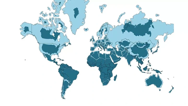
Reddit users are scratching their heads after coming across a map that accurately represents the real size and shape of countries, including Greenland. This has sparked confusion, as many traditional maps tend to exaggerate or distort the actual dimensions of various nations.
View pictures in App save up to 80% data.
A recent map highlighting the actual size of certain countries has taken many by surprise.
Reddit users have been surprised by a map showing the real size of countries was posted on the site, in the week after Donald Trump showed he quite fancied a slice of Greenland - an autonomous Danish territory that looks far bigger on typical maps than it actually is.
The Mercator Map Projection was developed by a Flemish cartographer named Gerardus Mercator in 1569 and it is one of the most well-known map projections. It was originally designed for navigation purposes, despite this meaning that many countries featured on the map are distorted in shape and size. A map posted on Reddit, however, shows countries true to their shape and size.
One user commented: "So Brazil is actually enormous."
View pictures in App save up to 80% data.
Another user added: "It’s always mind-blowing to see how distorted the Mercator projection really is. For example, Greenland looks almost the same size as Africa on that map, but in reality, Africa is about 14 times bigger! Australia and South America also look way larger than they actually are compared to other continents.
"The Mercator projection was once a valuable tool for navigation, but it significantly distorted our perception of the world. It's astonishing to realize that many of us were raised with such a warped understanding of geography!"
The distortion seen in the Mercator projection arises from its method of projecting the Earth's surface onto a cylindrical shape. This results in a significant enlargement of regions close to the poles, making them appear much larger than regions near the equator. To preserve the straightness of longitude and latitude lines, the Mercator projection elongates the map in the vertical direction, which consequently affects the relative size and shape of various countries.
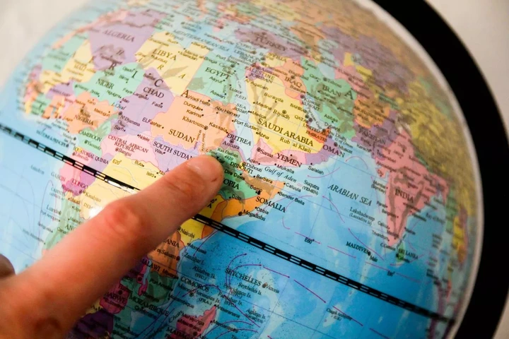
One country — Greenland — appears evidently bigger on the map posted compared to Mercator projection maps. In recent days Trump has made it apparent that he wishes to take control of Greenland, a largely autonomous territory of Denmark in the Arctic and the world's largest island.
Although he initially expressed his desire to purchase Greenland in 2019, recent days have seen him escalate his stance, openly suggesting the possibility of using economic or military means to assert control over the island.
The map showing the real sizes of countries across the world provides an insight into how large Greenland really is, and the potential reason why Trump may want to take control over it. Other countries have responded negatively to his ambition, saying that Greenland is not for sale and that its territorial integrity must be preserved.
Approximately 80% of Greenland is blanketed in ice, yet it possesses significant untapped mineral resources. With a population of just 56,000, the territory has been governed by Denmark for the past 300 years.
The country also has strategic benefits for America including Greenland its location between North America and Europe in the Arctic. In addition, the US already operates Thule Air Base in Greenland, which is a critical component of America's missile warning system and military presence in the Arctic.
A Reddit user pointed out Donald Trump's aspirations, remarking: "I came across a presidential hopeful who notices the vastness of Greenland and thinks... can we purchase that for America?!" In just a few days, on January 20, Donald Trump will officially assume the presidency of the United States, but whether he will pursue the acquisition of Greenland remains uncertain.